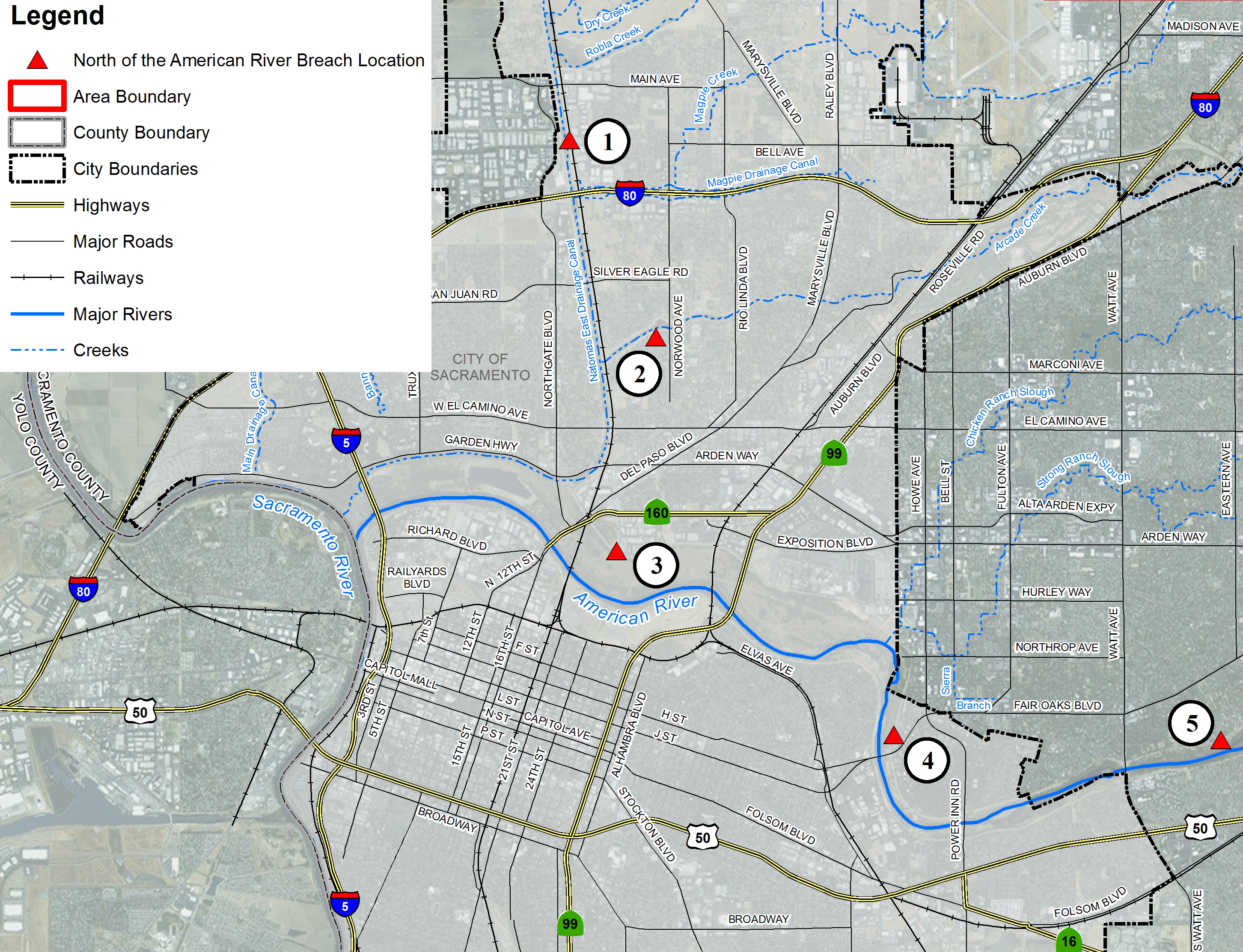
This map details the locations north of the American River where flooding could occur. Communities within this boundary include: Arden-Arcade, McClellan Park, North Highlands, and Rio Linda
The red triangles denote potential levee breach locations. The chart below are links to flood depth and evacuation maps for each area.